Within Haunted Wigtownshire
How Did Wigtownshire's Landscape Shape Its Ghosts?
The county's ghost map follows thresholds: cliff castles, tidal mud, ruined churches, lonely roads and antiquarian folklore collections.
On this page
- Rhinns, Machars and tidal edges
- Old books, local collectors and named traditions
- Why boundaries matter in ghost geography
Page outline Jump by section
Introduction
Wigtownshire’s ghost map is best understood as a map of thresholds: cliff-edge castles, tidal mudflats, mossy roads, ruined churches, ferry routes and old parish boundaries. The stories are not spread evenly across the historic county. They gather where people crossed from land to sea, safety to danger, Protestant memory to older folklore, and everyday travel to lonely night journeys. That is why Dunskey Castle above Portpatrick, Galdenoch Tower near Leswalt, the road to High Ardwell, Kirkmaiden in Fernes by Luce Bay, Glenluce, Wigtown and the Bladnoch mudflats matter more than a simple list of “haunted places” suggests.
The older source trail also matters. Wigtownshire’s haunted reputation is not built mainly from modern ghost-tour marketing. Much of it runs through antiquarian and religious writing, especially J. Maxwell Wood’s 1911 collection of south-west Scottish witchcraft, superstition and ghost lore, which moves through western Galloway before crossing into neighbouring districts. Read carefully, those sources show a county whose supernatural stories are local, place-bound and often morally charged, rather than a county of grand theatrical hauntings.[Project Gutenberg]gutenberg.orgWitchcraft and Superstitious Record in the South-Western District of Scotland, by J. Maxwell Wood—A Project Gutenberg eBook…

Why Wigtownshire’s ghosts follow edges
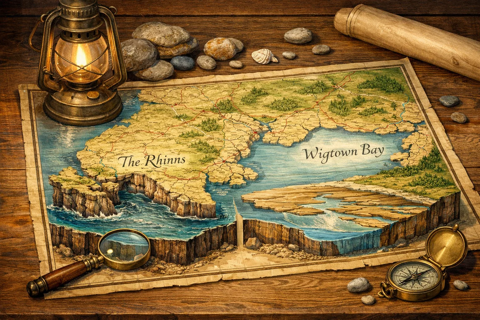
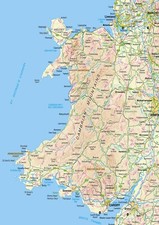
Historic Wigtownshire sits at the far south-west of Scotland, forming the western part of Galloway. The Rhinns of Galloway make the county’s western “hammer-head” peninsula, with Loch Ryan and Luce Bay cutting deeply into the map, while the Machars form a low triangular peninsula between Wigtown Bay and Luce Bay. This geography gives the county a strong coastal character: bays, inlets, ferry routes, mudflats, sea-facing ruins and small settlements set between landward farms and open water.[Gazetteer]gazetteer.org.ukGazetteer Wigtownshire, historiccounty | Gazetteer of British Place NamesGazetteer Wigtownshire, historiccounty | Gazetteer of British Place Names
That physical shape helps explain the character of the ghost stories. Wigtownshire’s best-known eerie places are often not enclosed rooms but liminal sites: Dunskey on a promontory above the sea; Wigtown’s Martyrs’ Stake out on tidal ground; Kirkmaiden in Fernes on the edge of Luce Bay; Portpatrick and the Rhinns facing Ireland; and mossy inland roads where travellers were imagined as vulnerable to lights, apparitions and misleading figures. The county’s folklore repeatedly turns landscape hazards into supernatural form.
Dunskey Castle is the clearest example. The official historic environment record places it in Portpatrick parish, in the former county of Wigtownshire, and describes a castle occupying a sea-jutting promontory partly cut off from the mainland by a deep ditch. The record also notes that the present building probably dates to the early sixteenth century, though the site may have been fortified earlier, and that it was already ruinous by 1684.[Trove Scot]trove.scotScot Dunskey Castle | Place | trove.scotScot Dunskey Castle | Place | trove.scot This is exactly the kind of place where a story can cling: a cut-off ruin, caves below, a dangerous shore, and a view westward across the North Channel.
Wood’s Dunskey story makes the geography do the haunting. He records the tradition of an Irish piper imprisoned by Walter de Curry, who is said to have escaped into a secret passage leading from the castle to a sea cave but died there, leaving his ghost to pace the underground route while playing uncanny music. The story is not simply “a ghost in a castle”. It is a tale of sound travelling through hidden spaces between dungeon, cliff and cave.[Project Gutenberg]gutenberg.orgWitchcraft and Superstitious Record in the South-Western District of Scotland, by J. Maxwell Wood—A Project Gutenberg eBook…
That pattern recurs across the county. A ghost is often imagined as a sign that a boundary has been crossed wrongly: a prisoner moves from castle to cave and never returns; a traveller meets a white woman on the road; a young man rides to a sacred ruin to prove his bravery and is found dead; religious dissenters are remembered at the point where land gives way to tide. Wigtownshire’s haunted geography is therefore less about isolated “spooky buildings” than about risky passages through a charged landscape.

Rhinns, Machars and tidal edges
The Rhinns carry many of the county’s strongest old traditions because they combine sea travel, old estates, lonely roads and visible ruins. Dunskey stands just south of Portpatrick, a village historically tied to the sea crossing towards Ireland. Modern visitor information still frames the ruin through its coastal setting: it lies half a mile south of Portpatrick, is visible from the coastal path, and has no access to the interior.[Scotland Starts Here]scotlandstartshere.comScotland Starts Here Dunskey Castle | History & HeritageScotland Starts Here Dunskey Castle | History & Heritage That restriction is worth noting for haunted-place readers: the atmosphere belongs largely to the view, the path, the cliff and the ruin, not to an accessible “haunted room”.
Galdenoch Tower, in Leswalt parish, shows a different Rhinns mechanism. Wood calls the Ghost of Galdenoch Tower “perhaps the best-known Galloway ghost story” and links it to the Agnews of Galdenoch, Covenanting conflict and a dead Royalist whose spirit allegedly followed a fugitive soldier home. The haunting is then said to have continued after changes of occupancy, making the tower unendurable as a farmhouse.[Project Gutenberg]gutenberg.orgWitchcraft and Superstitious Record in the South-Western District of Scotland, by J. Maxwell Wood—A Project Gutenberg eBook… Here the geography is estate geography rather than sea geography: the ghost moves with political violence into a family tower and then lingers as household disturbance.
The High Ardwell white woman belongs to the road network of the Rhinns. Wood’s version places a carrier on regular journeys to Portpatrick when the mail packet crossed to Ireland. On his way home, he is repeatedly troubled by a woman in white who stops his horse, breaks the cart’s progress and finally appears behind him on the horse.[Project Gutenberg]gutenberg.orgWitchcraft and Superstitious Record in the South-Western District of Scotland, by J. Maxwell Wood—A Project Gutenberg eBook… The tale is comic-grotesque in parts, but its setting is serious: a working traveller on a repeated route, after dark, between port and inland home. It is a ghost story built from transport, isolation and the vulnerability of routine.
The Machars and Luce Bay give Wigtownshire a different haunted texture. The Machars are low and gently rolling, without dramatic mountains; their ghost geography is more about churches, farms, shore roads and old religious sites than about Highland-style passes or battlefield grandeur. The Gazetteer of British Place Names places Whithorn at the southern end of the Machars and notes its early Christian importance, while also identifying Glenluce Abbey near Luce Bay as a Cistercian foundation from around 1190.[Gazetteer]gazetteer.org.ukGazetteer Wigtownshire, historiccounty | Gazetteer of British Place NamesGazetteer Wigtownshire, historiccounty | Gazetteer of British Place Names
Kirkmaiden in Fernes, in Glasserton parish, sits directly in this Luce Bay pattern. Wood describes its roofless pre-Reformation church as standing “on the very verge of Luce Bay” and attaches to it a tradition of supernatural intervention and tragedy: a young man wagers that he will ride to the ruined church and bring back the Bible, but he and his horse are later found dead in a gruesome and unexplained state.[Project Gutenberg]gutenberg.orgWitchcraft and Superstitious Record in the South-Western District of Scotland, by J. Maxwell Wood—A Project Gutenberg eBook… Whatever one makes of the tale, its logic is plain. The haunted place is a sacred ruin on a shore edge, and the offence is reckless intrusion into a charged religious site at night.
The Wigtown Martyrs’ Stake belongs to the most historically grounded side of this same tidal imagination. The tradition concerns Margaret Wilson and Margaret McLachlan, Covenanters said to have been drowned on 11 May 1685 on the mudflats near Wigtown for refusing to accept royal supremacy over the church. A Guardian walking feature frames the site through Wigtown Bay, the Bladnoch estuary and the “killing years” of 1680–85, while a present-day route from Wigtown to the stake uses tracks, grass and duckboards to reach the remembered place.[The Guardian]theguardian.comOpen source on theguardian.com.
This is not primarily a “ghost sighting” tradition, and it should not be forced into one. Its importance for Wigtownshire’s haunted geography is that it turns tide itself into memory. The rising water is the agent of death; the mudflat becomes an outdoor memorial; and later visitors re-enact the movement from town to estuary. It shows how the county’s eerie landscape includes martyrdom, not just apparition.
Old books, local collectors and named traditions
The single most useful old printed trail for Wigtownshire’s ghost geography is Wood’s Witchcraft and Superstitious Record in the South-Western District of Scotland, published in 1911 and now available through Project Gutenberg and archive copies. Its chapter “Ghost Lore and Haunted Houses” starts in western Galloway with Dunskey Castle before moving to Galdenoch, High Ardwell, Auchabrick, Kirkmaiden in Fernes and then onward into other parts of Galloway and Dumfriesshire.[Project Gutenberg]gutenberg.orgWitchcraft and Superstitious Record in the South-Western District of Scotland, by J. Maxwell Wood—A Project Gutenberg eBook…
That order is useful because it preserves a local route through the material. Wood is not presenting Wigtownshire as a modern tourism zone. He is “gleaning” traditions across south-west Scotland, and the Wigtownshire cluster appears as one stage in a west-to-east movement. For readers, this means the county’s old haunted trail should be read as a chain of parish and estate memories: Portpatrick, Leswalt, Stoneykirk, Kirkmaiden, Glasserton, Whithorn and Glenluce, rather than as an interchangeable list of famous Scottish ghosts.
The source trail is also uneven. Some stories have named preservers or older printed anchors; others are admitted as whispers. Galdenoch is explicitly given through Sir Andrew Agnew’s tradition, linking the ghost to a named family memory and Covenanting conflict.[Project Gutenberg]gutenberg.orgWitchcraft and Superstitious Record in the South-Western District of Scotland, by J. Maxwell Wood—A Project Gutenberg eBook… The Glenluce Devil has a much older and more complicated paper trail: Mark Jardine notes that the alleged disturbances in Gilbert Campbell’s household in 1655–56 were first recorded in a 1661 letter by Robert Baillie, then appeared in George Sinclair’s Satan’s Invisible World Discovered, published in 1685.[Jardine's Book of Martyrs]drmarkjardine.wordpress.comOpen source on wordpress.com.
The Glenluce case is important because it shows how quickly a local disturbance could become religious evidence. Jardine’s summary presents the case as an alleged spirit or devil troubling a weaver’s household, while also asking whether the explanation might have been hysteria or the actions of children.[Jardine's Book of Martyrs]drmarkjardine.wordpress.comOpen source on wordpress.com. That sceptical question belongs on any modern Wigtownshire haunted page. Seventeenth-century accounts of spirits were often written to defend religious beliefs about devils, providence and moral disorder; they are not neutral witness statements in the modern sense.
Wood himself gives readers clues about reliability. At Auchenmalg, on the eastern shore of Luce Bay, he records only “a whisper” that the old barracks were haunted and says little definite could be gleaned beyond an association with violence in the smuggling days.[Project Gutenberg]gutenberg.orgWitchcraft and Superstitious Record in the South-Western District of Scotland, by J. Maxwell Wood—A Project Gutenberg eBook… That is a model for cautious treatment. Not every atmospheric ruin deserves a fully inflated ghost story. Some places have strong named traditions; others have only a faint local rumour.
A practical way to read Wigtownshire’s old source trail is to separate three layers:
- Documented historic places: Dunskey Castle, Wigtown’s Martyrs’ Stake route, Glenluce, Whithorn and Kirkmaiden can be located and contextualised through historic environment records, gazetteers or visitor routes.[trove.scot]trove.scotScot Dunskey Castle | Place | trove.scotScot Dunskey Castle | Place | trove.scot
- Collected folklore: Dunskey’s piper, Galdenoch’s ghost, the High Ardwell white woman and the Kirkmaiden wager survive mainly as traditions recorded in antiquarian form.[Project Gutenberg]gutenberg.orgProject GutenbergWitchcraft and Superstitious Record in the South-Western District of Scotland, by J. Maxwell Wood—A Project Gutenberg eBook…
- Religious supernatural controversy: The Glenluce Devil and Covenanting martyr narratives belong to a world where supernatural interpretation, persecution memory and polemical writing overlap.[Jardine's Book of Martyrs]drmarkjardine.wordpress.comOpen source on wordpress.com.
That layered reading keeps the page atmospheric without flattening very different kinds of evidence into the same category.

Why boundaries matter in ghost geography
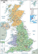
Wigtownshire’s haunted geography is easy to blur because modern Dumfries and Galloway combines several older territories. The National Library of Scotland notes that the unitary region of Dumfries and Galloway was created in 1975 and brought together the historic counties of Dumfriesshire, Wigtownshire and the Stewartry of Kirkcudbright.[National Library of Scotland Blog]blog.nls.ukzoom into dumfries and gallowayzoom into dumfries and galloway For ghost research, that administrative change matters. A modern regional article may legitimately range from Stranraer to Dumfries, but a historic-county page should not treat every south-west Scottish haunting as Wigtownshire.
The wider UK project’s historic-county frame is also supported by the Wikishire and Wikimedia map tradition. Wikimedia Commons hosts an SVG map of the historic counties of the United Kingdom based on Wikishire border data, while Wikishire describes the United Kingdom as having 92 historic counties or shires.[Wikimedia Commons]commons.wikimedia.orgOpen source on wikimedia.org. Within that frame, Wigtownshire is not just “west Dumfries and Galloway”. It is the old western shire of Galloway, with its own coastline, parish pattern and source trail.
This prevents two common mistakes. The first is importing famous neighbouring stories because they are nearby or regionally marketed. Wood’s own chapter moves out of Wigtownshire into Kirkcudbrightshire and Dumfriesshire, but that movement should not erase the old county line. A tale such as the Ringcroft of Stocking apparition belongs to the parish of Rerrick in the Stewartry of Kirkcudbright, not to Wigtownshire, even though it appears in the same south-western supernatural tradition and in the appendix trail around Wood’s book.[The Trades House Digital Library]tradeshouselibrary.orgOpen source on tradeshouselibrary.org.
The second mistake is treating the county as if its ghosts were all castle-based. Wigtownshire does have tower-house and ruined-castle traditions, especially Dunskey and Galdenoch, but its haunted geography is broader: tidal execution memory at Wigtown, port roads at High Ardwell, church-ruin taboo at Kirkmaiden in Fernes, sea-facing witch place-names around Portpatrick, and older religious demonology at Glenluce. Wood even records “Witch Rocks of Portpatrick” as a place where witches were said to rest before flying on to Ireland, and mentions Stoneykirk place-names interpreted as witch-associated hills or gaps.[Project Gutenberg]gutenberg.orgWitchcraft and Superstitious Record in the South-Western District of Scotland, by J. Maxwell Wood—A Project Gutenberg eBook…
A good Wigtownshire ghost map therefore looks less like a pinboard of scares and more like a route through old anxieties. It follows roads to ports, paths to stakes, cliffs to caves, bays to ruined churches, and printed traditions back to the collectors who preserved them. The result is quieter than the famous haunted circuits of Edinburgh or the Highlands, but it is more distinctive: a coastal county where the supernatural often appears at the moment someone reaches the edge of safe ground.
Amazon book picks
Further Reading
Books and field guides related to How Did Wigtownshire's Landscape Shape Its Ghosts?. Use these as the next step if you want deeper reading beyond the article.
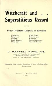
Witchcraft and superstitious record in the south-western dist...
First published 1911. Subjects: Folklore, Trials (Witchcraft), Witchcraft.

Scottish Myths and Legends
First published 2009. Subjects: Tales, Legends, Folklore, Legends, scotland.
eBay marketplace picks
Marketplace Samples
Live-tested eBay searches with available results related to this page.
Endnotes
1.
Source: gutenberg.org
Title: Project Gutenberg
Link:https://www.gutenberg.org/files/43966/43966-h/43966-h.htm
Source snippet
Witchcraft and Superstitious Record in the South-Western District of Scotland, by J. Maxwell Wood—A Project Gutenberg eBook...
2.
Source: trove.scot
Title: Scot Dunskey Castle | Place | trove.scot
Link:https://www.trove.scot/place/60632
3.
Source: gutenberg.org
Title: Project Gutenberg
Link:https://www.gutenberg.org/cache/epub/43966/pg43966-images.html
Source snippet
Witchcraft and Superstitious Record in the South-Western District of Scotland, by J. Maxwell Wood—A Project Gutenberg eBook...
4.
Source: commons.wikimedia.org
Link:https://commons.wikimedia.org/wiki/File%3AHistoric_counties_of_the_United_Kingdom.svg
5.
Source: gutenberg.org
Link:https://www.gutenberg.org/ebooks/43966
6.
Source: commons.wikimedia.org
Title: Category:SVG maps of historic counties of the United Kingdom
Link:https://commons.wikimedia.org/wiki/Category%3ASVG_maps_of_historic_counties_of_the_United_Kingdom
7.
Source: commons.wikimedia.org
Link:https://commons.wikimedia.org/wiki/File%3ABritish_Isles_map_showing_UK%2C_Republic_of_Ireland%2C_and_historic_counties.svg
8.
Source: commons.wikimedia.org
Title: Category:Maps of historic counties of the United Kingdom
Link:https://commons.wikimedia.org/wiki/Category%3AMaps_of_historic_counties_of_the_United_Kingdom
9.
Source: archive.org
Link:https://archive.org/details/witchcraftsupers00woodiala
10.
Source: dn790007.ca.archive.org
Link:https://dn790007.ca.archive.org/0/items/studiesintopogra00maxwiala/studiesintopogra00maxwiala.pdf
11.
Source: boundaries.scot
Title: Local government Scotland before 1975
Link:https://www.boundaries.scot/wp-content/uploads/2026/03/Local_government_Scotland_before_1975.pdf
12.
Source: dunskey.com
Link:https://www.dunskey.com/
13.
Source: youtube.com
Link:https://www.youtube.com/watch?v=NxPVCjFBApE
Source snippet
The Wigtown Martyrs | Scotland's History...
14.
Source: youtube.com
Title: The Wigtown Martyrs | Scotland’s History
Link:https://www.youtube.com/watch?v=DuozY6h7fgQ
Source snippet
The Devil Of Glenluce - Scared to Death...
15.
Source: gazetteer.org.uk
Title: Gazetteer Wigtownshire, historiccounty | Gazetteer of British Place Names
Link:https://gazetteer.org.uk/place/Wigtownshire
16.
Source: scotlandstartshere.com
Title: Scotland Starts Here Dunskey Castle | History & Heritage
Link:https://scotlandstartshere.com/point-of-interest/dunskey-castle/
17.
Source: theguardian.com
Link:https://www.theguardian.com/travel/2009/jun/08/wigtown-martyrs-walking-guide-dumfries
18.
Source: scotlandstartshere.com
Link:https://scotlandstartshere.com/tours/lovers-walk-martyrs-stake-and-wigtown-harbour/
19.
Source: drmarkjardine.wordpress.com
Link:https://drmarkjardine.wordpress.com/2015/02/23/the-devil-of-glenluce-satans-invisible-world-discovered/
20.
Source: blog.nls.uk
Title: zoom into dumfries and galloway
Link:https://blog.nls.uk/zoom-into-dumfries-and-galloway/
21.
Source: wikishire.co.uk
Title: unties of the United Kingdom
Link:https://wikishire.co.uk/wiki/Counties_of_the_United_Kingdom
22.
Source: tradeshouselibrary.org
Link:https://www.tradeshouselibrary.org/uploads/4/7/7/2/47723681/bibliographical_notes_on_the_witchcraft_literature_of_scotland.pdf
23.
Source: freepages.rootsweb.com
Link:https://freepages.rootsweb.com/~ainsty/history/articles/humour/ghost.html
24.
Source: Wikipedia
Link:https://en.wikipedia.org/wiki/Wigtownshire
25.
Source: Wikipedia
Title: Wigtown Martyrs
Link:https://en.wikipedia.org/wiki/Wigtown_Martyrs
26.
Source: Wikipedia
Title: Dunskey Castle
Link:https://en.wikipedia.org/wiki/Dunskey_Castle
27.
Source: Wikipedia
Title: Dumfries and Galloway
Link:https://en.wikipedia.org/wiki/Dumfries_and_Galloway
28.
Source: wikishire.co.uk
Title: Dunskey Castle
Link:https://wikishire.co.uk/wiki/Dunskey_Castle
29.
Source: darkgalloway.wordpress.com
Link:https://darkgalloway.wordpress.com/?query-8-page=2
30.
Source: drmarkjardine.wordpress.com
Title: the eight days of the keppoch devil near glasgow history scotland
Link:https://drmarkjardine.wordpress.com/2017/01/20/the-eight-days-of-the-keppoch-devil-near-glasgow-history-scotland/
31.
Source: spotonlocations.wordpress.com
Title: the wigtown martyrs
Link:https://spotonlocations.wordpress.com/2023/07/26/the-wigtown-martyrs/
32.
Source: paranormalscholar.com
Title: Witchcraft and Superstitious Record
Link:https://www.paranormalscholar.com/wp-content/uploads/2018/11/Witchcraft-and-Superstitious-Record-in-the-South-Western-District-of-Scotland-J.-Maxwell-Wood-1911.pdf
33.
Source: britainexpress.com
Title: wigtown martyrs
Link:https://www.britainexpress.com/scotland/Dumfries-Galloway/properties/wigtown-martyrs.htm
34.
Source: undiscoveredscotland.co.uk
Link:https://www.undiscoveredscotland.co.uk/usfeatures/areas/wigtownshire.html
35.
Source: deriv.nls.uk
Link:https://deriv.nls.uk/dcn23/9489/94898125.23.pdf
36.
Source: blog.nls.uk
Link:https://blog.nls.uk/tag/local-history/page/2/
37.
Source: coastalkippford.com
Link:https://www.coastalkippford.com/wigtown-plan-your-visit-to-scotlands-historical-book-town/
Additional References
38.
Source: youtube.com
Title: Dunskey Castle History (Portpatrick) & a Look Inside
Link:https://www.youtube.com/watch?v=-2HrL6Wu4LM
Source snippet
The Most Mysterious Island in Scotland | Cruel, Sacred, Haunted...
39.
Source: facebook.com
Link:https://www.facebook.com/scottishoutlook/videos/dunskey-castle-is-a-ruined-12th-century-tower-house-or-castle-located-05-miles-0/1012069846977050/
40.
Source: facebook.com
Link:https://www.facebook.com/groups/scotlandsscenery/posts/8035496789802957/
41.
Source: evendo.com
Link:https://evendo.com/locations/united-kingdom/wigtownshire/landmark/galdenoch-castle
42.
Source: historiccountiestrust.co.uk
Link:https://historiccountiestrust.co.uk/descriptions
43.
Source: facebook.com
Link:https://www.facebook.com/RealCounties/posts/looking-for-a-detailed-map-of-the-historiccounties-of-england-ireland-scotland-a/711005821182988/
44.
Source: visionofbritain.org.uk
Link:https://www.visionofbritain.org.uk/place/17445
45.
Source: scotsmagazine.com
Link:https://www.scotsmagazine.com/articles/scotlanders-dunskey-castle/
46.
Source: facebook.com
Link:https://www.facebook.com/groups/Welovedumfriesandgalloway/posts/31293067127008733/
47.
Source: fairfieldgenealogysociety.org
Link:https://fairfieldgenealogysociety.org/Members_Only/World%20Research/Scotland/Documents/Hereditary%20sheriffs%20of%20Galloway%2C%20Volume%201%20%281893%29.pdf
Topic Tree